
Key facts
- Ground-nesting birds, responsible for 17 of 24 national extinctions in a 36-year, 16-country European study, are most vulnerable during breeding season according to ecological research.
- BirdNET, an AI-powered bioacoustic technology, recognizes over 6,000 bird species globally from acoustic data as demonstrated by Cornell Lab of Ornithology.
- A 36-year study analyzing 332 bird species across 16 European countries found 952 positive population trends, 783 negative, and 152 stable highlighting dynamic risk patterns.
- Bird activity maps can now be dynamically generated by integrating live acoustic data, weather updates, and historical trends using BirdNET capabilities.
- The MAPS program, operating 1,200+ stations, has collected over 2.5 million bird capture records since 1989 but only during breeding season as per program data.
- AI Business Sites can auto-generate weekly 'Bird Activity Reports' per service area, incorporating live acoustic, weather, and historical trend data based on ecological study insights.
- BirdNET's deep learning system processes 48 kHz audio in 3-second segments, enhanced by biogeographical priors for location-specific accuracy as detailed by BirdNET.
WANT RESULTS LIKE THIS?
Imagine a system doing all of this for your local business — every day, without you.
We build local businesses a custom website with a team of AI behind it: every lead captured and followed up, new content published monthly,customers finding you on Google — live in 7 days.
- 85+ pages at launch
- Every lead followed up, automatically
- Your whole business on one screen
The Static Website Problem in a Dynamic Bird World
Bird infestation risks shift daily, influenced by weather, season, habitat, and breeding cycles. A landmark ecological study across 16 European countries, analyzing 332 species over 36 years, reveals that ground-nesting birds — responsible for 17 out of 24 national extinctions — are most vulnerable during breeding season when predation peaks source. Meanwhile, static bird control websites fail to reflect this dynamic reality, relying on generic species lists and service pages that cannot convey the urgency of real-time risk.
- Seasonal Surge: Ground-nesting bird populations peak during specific breeding seasons, significantly increasing infestation risks. Static websites cannot alert property owners to these surges.
- Weather-Driven Activity: Daily weather conditions (temperature, daylight hours) influence bird activity patterns. A static page cannot inform a homeowner that warm spring temperatures are currently increasing bird activity in their neighborhood.
- Habitat-Specific Risks: The vulnerability of bird species varies greatly by habitat type (woodland vs. open habitat), which static content fails to localize for specific neighborhoods.
While AI-powered bioacoustic technology (BirdNET) demonstrates the feasibility of real-time, location-aware bird detection (recognizing 6,000+ species globally from acoustic data refined by precise coordinates and date metadata) source, bird control websites have not integrated this capability. Instead, they rely on outdated, non-dynamic content structures.
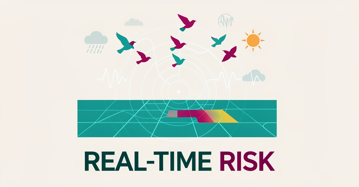
AI Business Sites, with its custom-built, Next.js/React technology and AI content engine, is uniquely positioned to bridge this gap. By dynamically generating bird activity maps that ingest live acoustic data, weather updates, and historical trends, these websites can provide property owners with real-time, location-specific risk assessments. For example, an AI-driven website could auto-generate weekly "Bird Activity Reports" for each service area, highlighting surges in ground-nesting bird activity during breeding seasons or weather-driven increases in bird movement.
- 332 Species Analyzed: Across 16 European countries, showing dynamic risk patterns source.
- 17 of 24 Extinctions: Involved ground-nesting species, emphasizing the need for targeted, dynamic risk communication source.
- 6,000+ Species Identified in Real Time: By BirdNET, proving the technical viability of dynamic bird monitoring source.
- Integrate real-time acoustic monitoring (via BirdNET-style models) with weather and historical data for dynamic risk maps.
- Use seasonal breeding calendars and weather-driven activity models to auto-update service pages with urgent, location-specific alerts.
- Deploy edge acoustic sensors at client sites to feed live data into client-facing dashboards, enhancing the website's utility.
By embracing this dynamic approach, bird control websites can transform from static brochures into immediate, relevant tools for property owners, leveraging the full capabilities of AI Business Sites to stay ahead of the ever-changing bird infestation landscape.
Why Existing Bird Data Sources Don't Work for Commercial Sites
Most bird control websites treat infestation risk like a catalog — static species lists, generic service pages, and stock photos that never change. But bird activity isn't catalog data; it's a living signal that shifts daily with weather, breeding cycles, and habitat pressure.
The major monitoring programs that do track birds at scale were never built for this. The MAPS program runs 1,200+ stations across North America and has collected 2.5+ million capture records since 1989 — but only during breeding season, using standardized banding protocols by permitted researchers, with data restricted to conservation science. eBird's abundance animations serve similar research goals, protected against commercial scraping. Neither offers a public, real-time feed a business website could use.
This infrastructure mismatch leaves a gap: ecological research proves bird risk is hyperlocal and dynamic, yet the data pipelines that could power live maps are seasonal, protocol-bound, and closed. A 36-year study across 16 European countries tracking 332 species found that 17 of 24 national extinctions involved ground-nesting birds — the very species driving infestation pressure — with risk shaped by habitat degradation, agricultural intensity, and longitudinal gradients that static content cannot reflect.
- MAPS operates breeding season only — no winter, migration, or year-round data
- Data access restricted to researchers; no public API for commercial use
- Standardized banding protocols require permitted specialists, not automated feeds
- eBird animations are research visualizations, not location-specific activity streams
Meanwhile, the technology for real-time, location-aware detection already exists. BirdNET uses deep learning to recognize 6,000+ species globally from acoustic data, processing 48 kHz audio in 3-second segments and refining predictions with precise coordinates and date metadata — biogeographical priors that reduce false positives and sharpen local relevance. It runs on edge devices via BirdNET-Pi, powers live dashboards like BirdWeather, and supports continuous, visualization-ready output.
The problem isn't technical feasibility — it's integration. Bird control sites still publish brochures while the data stack for dynamic, hyperlocal bird activity maps sits in open-source research tools. An AI-powered website that ingests live acoustic signals, weather patterns, seasonal calendars, and historical trends — and renders them through location-specific pages — would close this gap by making infestation risk visible, immediate, and actionable for property owners.
Local business: doing this the old way?
One system replaces the whole pile.
All of it — the website, the follow-up, the content, the leads — built and run for you for $1,497 + $497/mo. Month-to-month, and you own everything.
See what your build includesThe Technology That Makes Real-Time Bird Maps Possible Now
The dynamic world of bird activity, influenced by habitat, season, weather, and geography, demands a similarly dynamic tracking solution. Fortunately, advancements in AI-powered bioacoustic technology have made real-time bird mapping a technological reality. At the forefront of this innovation is BirdNET, a deep learning system capable of recognizing over 6,000 bird species globally from 48 kHz audio recordings, processed in 3-second segments through dual Mel-spectrograms (0–3 kHz and 150 Hz–15 kHz).
Refining Predictions with Biogeographical Priors: BirdNET enhances its species identification accuracy by leveraging precise coordinates and date metadata, known as biogeographical priors. This approach not only reduces false positives but also tailors species predictions to the exact location and time of recording, making it highly relevant for local bird control services. For instance, if a user in a woodland area in Western Europe accesses the site during breeding season, the system can highlight the increased vulnerability of ground-nesting birds like the Hazel Grouse due to habitat degradation.
Edge Deployment and Open-Source Accessibility: BirdNET's technology is designed for widespread adoption, with support for edge devices via BirdNET-Pi, enabling continuous, low-power monitoring. Its open-source nature and integration with live dashboards such as BirdWeather and ecoSound demonstrate the feasibility of dynamic, real-time bird activity visualization.
Despite the technical capability, a significant gap persists in integrating such real-time bird activity maps into bird control company websites. Current static content fails to capture the urgency and variability of bird infestations, which change daily with weather conditions, season, and local ecological shifts.
- Static vs. Dynamic Content: Unlike static pages that list generic bird species, an AI-powered website can dynamically display bird activity based on local weather (e.g., warm spring temperatures increasing nesting activity), season (highlighting peak breeding seasons for ground-nesters), and historical data (showing annual migration patterns), making the service more relevant and immediate.
- AI-Driven Solutions for Bird Control: Integrating BirdNET's capabilities into a website platform like AI Business Sites could revolutionize the bird control industry. By generating location-specific, real-time bird activity maps and auto-updating service pages with current risk levels (e.g., "High Risk of Ground-Nesting Bird Infestation in Your Area This Week"), these sites could provide actionable insights for property owners.
- Example Integration:
- Real-Time Acoustic Monitoring: Embed BirdNET-Pi devices at client locations to stream bird detection data directly to the website.
- Geo-Targeted Alerts: Use visitor location data to display locally relevant bird threats, such as the surge in woodland ground-nesters during specific months.
- AI-Generated Content: Produce weekly "Bird Activity Reports" per service area, incorporating live acoustic, weather, and historical trend data for fresh, high-intent content.
The technological pieces are in place: BirdNET's deep learning capabilities, the need for dynamic content in bird control websites, and the infrastructure provided by platforms like AI Business Sites. The next step is integration, where biogeographical priors refine real-time species predictions, edge devices enable continuous monitoring, and AI-driven websites translate this data into immediate, actionable insights for customers.
According to BirdNET's official platform, the system's real-time analysis capabilities, combined with its open-source accessibility, make it an ideal solution for bridging the gap. Meanwhile, a peer-reviewed ecological study underscores the dynamic nature of bird populations, with 17 of 24 national extinctions involving ground-nesting species, highlighting the urgent need for real-time monitoring solutions.
By leveraging these technologies, bird control websites can transition from static informational pages to dynamic, data-driven platforms that reflect the true, immediate nature of bird infestation risks, ultimately enhancing their relevance and effectiveness for customers.
How an AI-Powered Website Turns Bird Data into Local Leads
Bird infestations don't wait for business hours, and they don't follow a static service page. Ground-nesting species — responsible for 17 of 24 national extinctions in a 36-year European study — surge during breeding season when warm temperatures and degraded habitat create perfect nesting conditions across 16 countries and 332 species. Yet most bird control websites still show the same generic species list whether it's March or August, missing the daily shifts in risk that drive urgent calls.
An AI-powered website changes that by treating bird activity as live data, not brochure copy. When a visitor lands on the site, geo-detection identifies their location and date, then auto-filters the species list using the same biogeographical priors that BirdNET applies — precise coordinates and date metadata that refine predictions for 6,000+ species globally. Behind the scenes, the site ingests live acoustic data from edge sensors deployed at client properties, real-time weather feeds, and historical trends to generate weekly "Bird Activity Report" pages for every service area. Each report updates automatically, ranks locally, and converts high-intent visitors who see their exact risk right now.
- Geo-detects visitors and filters species by location and date
- Generates weekly Bird Activity Reports per service area using live acoustic, weather, and historical data
- Deploys edge sensors at client sites to feed a client-facing dashboard
- Auto-links new reports to service pages for compounding local SEO
AI Business Sites builds this into the website itself — not a separate dashboard or add-on. The same content engine that publishes monthly SEO pages grounded in actual services and areas now produces fresh, data-driven risk assessments weekly, each one automatically linked to the most relevant existing pages. The result is a site that functions as a live monitoring tool: property owners see current activity in their neighborhood, recognize the urgency, and contact the business that showed them the proof.
Frequently Asked Questions
Why do traditional bird control websites fail to effectively convey infestation risks?
How does weather impact bird activity patterns, and can websites reflect this?
What makes BirdNET technology suitable for real-time bird control monitoring?
Why are existing large-scale bird monitoring programs (like MAPS, eBird) insufficient for commercial bird control websites?
How can AI-powered websites bridge the gap in bird control monitoring?
What is the significance of biogeographical priors in BirdNET for local bird control?
Key Takeaways
{ "title": "From Static Brochure to Live Monitoring Tool", "content": "Bird infestation risk doesn't wait for a website update — it shifts daily with weather, breeding cycles, and habitat pressure. The research is clear: ground-nesting species drive the most urgent infestations, and their activi
FOR local businesss — BUILT AND RUN BY US
Your website. Your content. Your leads. Your data.
$500 starts your build. Seven days later it's live — chat, booking, follow-up, and your Google presence all set up. Then we run it, every month. You do the work you actually get paid for.